內容簡介
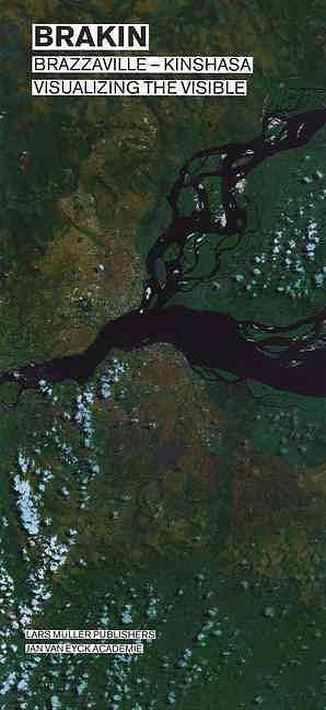
內容簡介 A group of researchers investigated the public spheres of Brazzaville and Kinshasa, two neighbouring capitals separated by the Congo river. The group subscribed to "visualizing the visible" as a common approach for their research and decided to consider Brazzaville and Kinshasa one city: Brakin.The researchers studied wide-ranging phenomena such as diamond trade, UN-presence, the Congo river, street children, mobile phone advertisements, street trade, roundabouts, land disputes, public space and the remains of housing projects. These phenomena were used as visible indicators for reading the urban environment.The visual indicators of the urban environment, as inventoried by the individual researchers, were used to produce commonly negotiated maps. To define the frame of the map, that is, to decide where the city stops, the group worked exclusively with the parameters in their inventories. Every map includes only one protocolled inventory at a time. No other references than the ones connected to this protocol are included in these maps. These references can be found in an extra section in the book, which shows reproductions of existing maps.